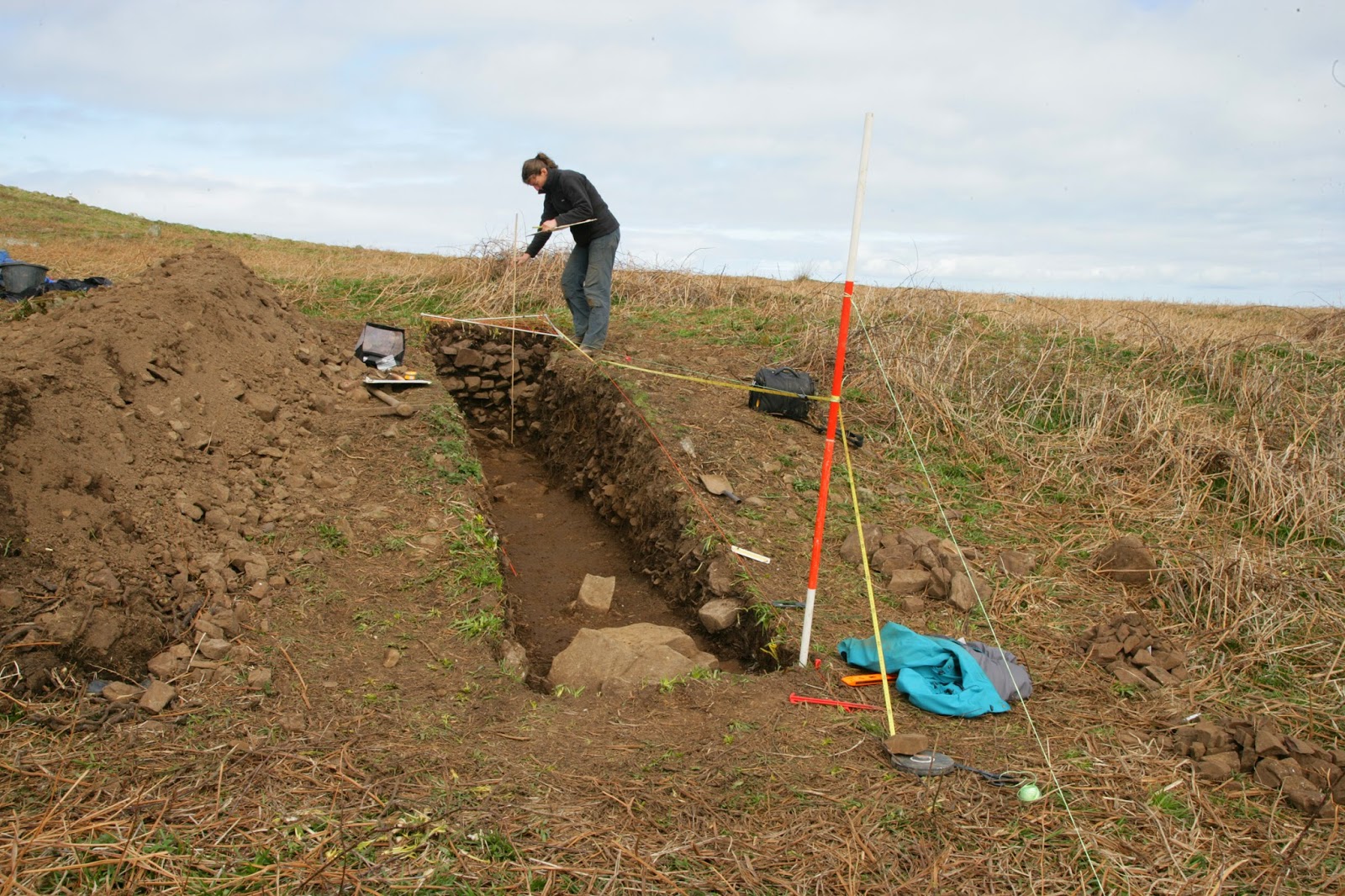
Excavations in 2014 at a prehistoric mound of burnt and fire-cracked stones on north Skomer, once used to boil water for cooking, have produced the first calibrated radiocarbon dates for farming settlement on this renowned island. The mound sealed a land surface dated by charcoal to between 520-458 cal BC, the early Iron Age. A cattle tooth deposited in the cooking mound while it was still in use was dated to between 116-54 cal BC, centred on 85 cal BC, the late Iron Age.
In April 2014 a small team of archaeologists was permitted to open the very first modern excavation trench in the island’s history, to retrieve dating and environmental samples to better understand the long and complex history of prehistoric settlement and farming on Skomer. This followed three years of collaborative, non-invasive research between staff of the Royal Commission, The University of Sheffield and Cardiff University, working closely with the Wildlife Trust of South and West Wales and Cadw.
Burnt mounds accumulated from a particular prehistoric cooking practice, which involved heating stones in a fire and then placing them into a water-filled wooden trough to boil the water. Once the water was boiling it could take around 3 hours to cook a joint of meat, with each successive cooking episode adding more waste burnt stones to the mound. The burnt mounds outside some of the roundhouse groups on Skomer Island are huge, and must have dominated the Iron Age landscape, alongside the conical thatched roofs of the houses.
Dr Toby Driver of the Royal Commission, Aberystwyth, explained:
‘Skomer is a fragile protected landscape, and our archaeological research to date has focussed on non-invasive investigation of the prehistoric fields and settlements. This has included new aerial photography, airborne laser scanning, ground geophysics and walkover surveys. Already we have discovered previously unknown Neolithic and Bronze Age ritual stone settings, and demonstrated that the field systems may date back to at least the later Bronze Age.’
‘But despite half a century of modern archaeological interest, we still had no scientific dates for the roundhouses and fields on Skomer. It was decided to target a prehistoric burnt mound or cooking mound of fire-cracked stones, which stands immediately outside one of the paired roundhouses. This mound built up from numerous cooking episodes in the adjacent house. Our excavation discovered a cattle tooth from within the mound of stones, which has now been radiocarbon dated to the late Iron Age. Beneath the mound we found a sealed land surface containing Neolithic or Bronze Age worked flint tools. A second radiocarbon date from blackthorn charcoal in the upper soil layers gave a an early Iron Age date, possibly from burning and clearance on the land, which showed our burnt mound and the houses it belongs to arrived after the early Iron Age. Both dates are accurate to within 62 years.’
‘These new dates confirm pre-Roman settlement on Skomer. Even so, the burnt mound covers a substantial earlier field wall showing that the island was already well settled and farmed in previous centuries.’
Find out more online
Photographs, maps and plans can be seen online at the Royal Commission’s online database www.coflein.gov.uk . Search for ‘Skomer’ to see all records, or ‘Skomer hut group 8’ to see a selection of the 2014 excavation photographs.Direct link: http://www.coflein.gov.uk/en/site/420196/details/SKOMER+ISLAND+HUT+GROUP+8/
Links to related BBC news stories: http://www.bbc.co.uk/news/uk-wales-south-west-wales-17644413
More about the Skomer Island archaeological project
Skomer is a highly protected landscape famous for its puffins and other breeding seabirds, but it is also home to some of the best preserved prehistoric field systems and hut settlements anywhere in Britain. In 2011 the Royal Commission used airborne laser scanning (LiDAR) to comprehensively map the island’s field systems. This work discovered evidence for a longer chronology to the fields than had previously been thought. The Skomer Island Project built on this work in 2012 with the first use of geophysics on the island, which showed that unrecorded prehistoric fields and settlements survive beneath the modern fields in the centre of the island.The Skomer Island Project team, Louise Barker and Dr Toby Driver (Royal Commission), Dr Bob Johnston (University of Sheffield) and Dr Oliver Davis (Cardiff University) would like to thank the Skomer Island Wardens, the Wildlife Trust of South and West Wales and Natural Resources Wales for accommodating the archaeological work and granting permission to work in a Site of Special Scientific Interest. They are also grateful to Cadw for Scheduled Monument Consent which allowed the work to proceed.
Appendix: the radiocarbon dates
SKOMER ISLANDSUERC-54181 (GU34955)
Context: 107, charcoal derived from buried soil layer beneath burnt mound
Material: Prunus cf. Spinosa (probable blackthorn)
Radiocarbon age: 2439 ± 30 BP (before 1950 AD)
Calibrated date (95.4& probability): 519-459 cal. BC
SUERC-55129 (GU34956)
Context: 108, Find 24. Cattle tooth deposited in upper layers of burnt mound
Material: Cattle tooth: Cattle
Radiocarbon age: 2035 ± 31 BP (before 1950 AD)
Calibrated date (95.4& probability): 116-54 cal. BC
Tanysgrifiwch i Newyddion Treftadaeth Cymru a chofrestrwch ar gyfer yr RSS porthiant llawn: cliciwch y botwm RSS hwn
 a thanysgrifiwch!
Rydym hefyd ar gael ar:


Twitter Hashtag: #RCAHMWales


0 comments:
Post a Comment
www.rcahmw.gov.uk
Please comment and let us know your views or your news. Remember that what you write can be read by everyone. RCAHMW reserves the right not to publish offensive or inaccurate material.